Goat Track Loop
An iconic ride for Brisbane bike riders. Do it on your gravel bike or mountain bike for the maximum fun.
User Rating

![]()
![]() (46 reviews)
(46 reviews)


User Rating
![]()
![]()
![]()
![]()
![]() (0 reviews)
(0 reviews)
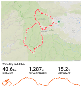
Many riders in Greater Brisbane will be familiar with The Goat Track, Mt Nebo, South Boundary Road and Mt Glorious. There are a number of forest roads and trails that drop from the heights of the range – but commiting to seeing where they go isn’t always attractive, as there’s a chance you may need to push back up!
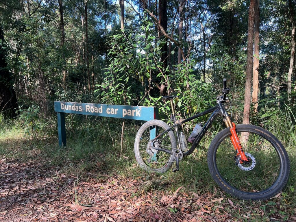
This route has been listed with a start in Highvale near the base of the Goat Track west of Samford, but could easily be started from Mt Nebo Village, or Dundas Road Carpark, which is just past the village. You could even ride up from the Brisbane Valley Rail Trail along Banks Creek Road!
The route has steep sections that don’t receive the same maintenance as routes like South Boundary Road. So while it is categorised as both a gravel ride and a mountain bike ride – it is an advanced gravel ride, and an intermediate mountain bike ride.
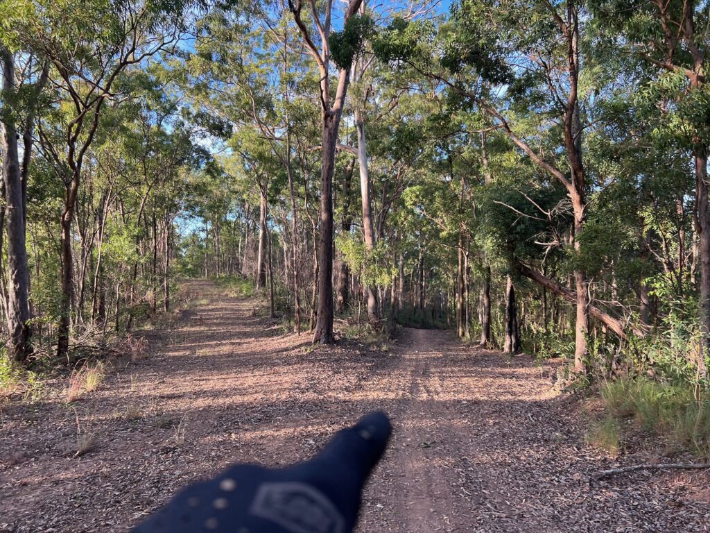
From the park opposite the end of Ryder Road in Highvale, head towards the Goat Track and ascend. This is still the easiest way up the range if you’re coming from this side, and the one way traffic is a delight. At the top, turn left to loop towards Forestry Road and over Hammermesiter road, before dropping back to Mt Nebo Road and to Dundas Carpark.
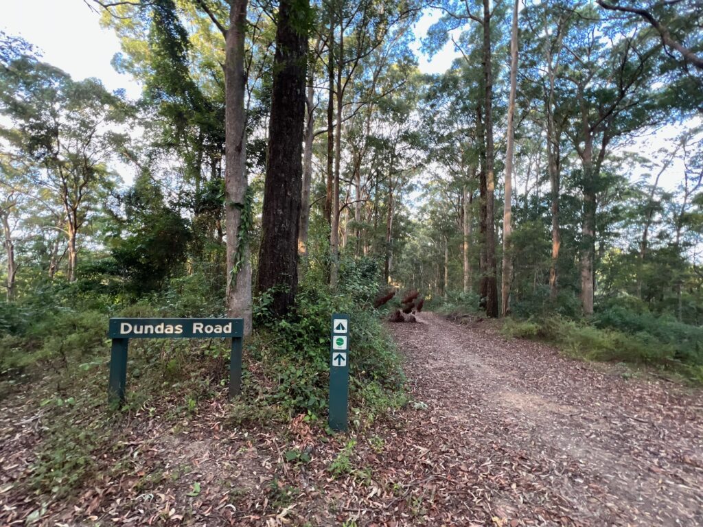
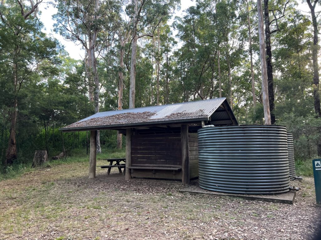
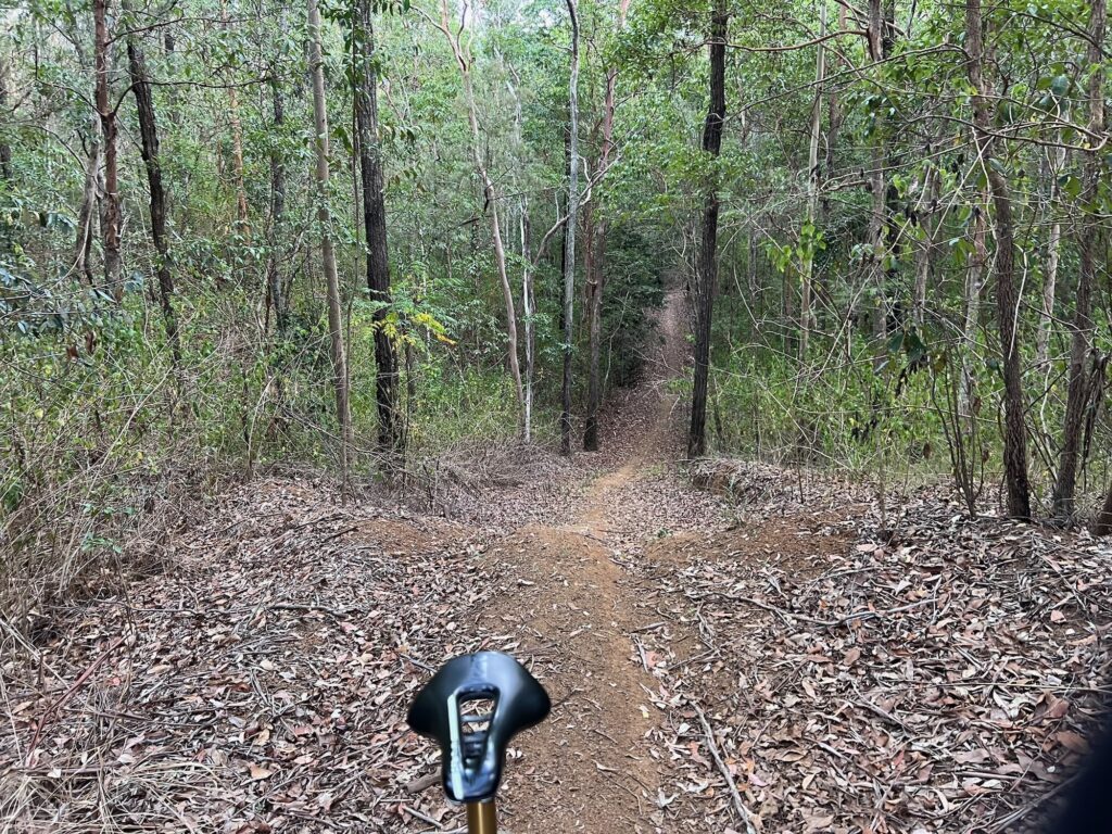
Go through the tiny tip to gain Dundas Road, and ride out on high quality firetrail to Dundas Bush Camp. The trail to the left is Cabbage Tree Road, in the middle leads to Whoa Boy, and to the right is Goodes Road. Today – we’re going straight on.
This route is frequented by trail bikes (no, they’re not meant to be there) and so you’ll typically have one very clear line to ride. It’s an undulating descent, and at the first turn option go left, as the right heads to private property. The descent gets a little steeper, and after the next plateau and small climb it descends steeply to the right.
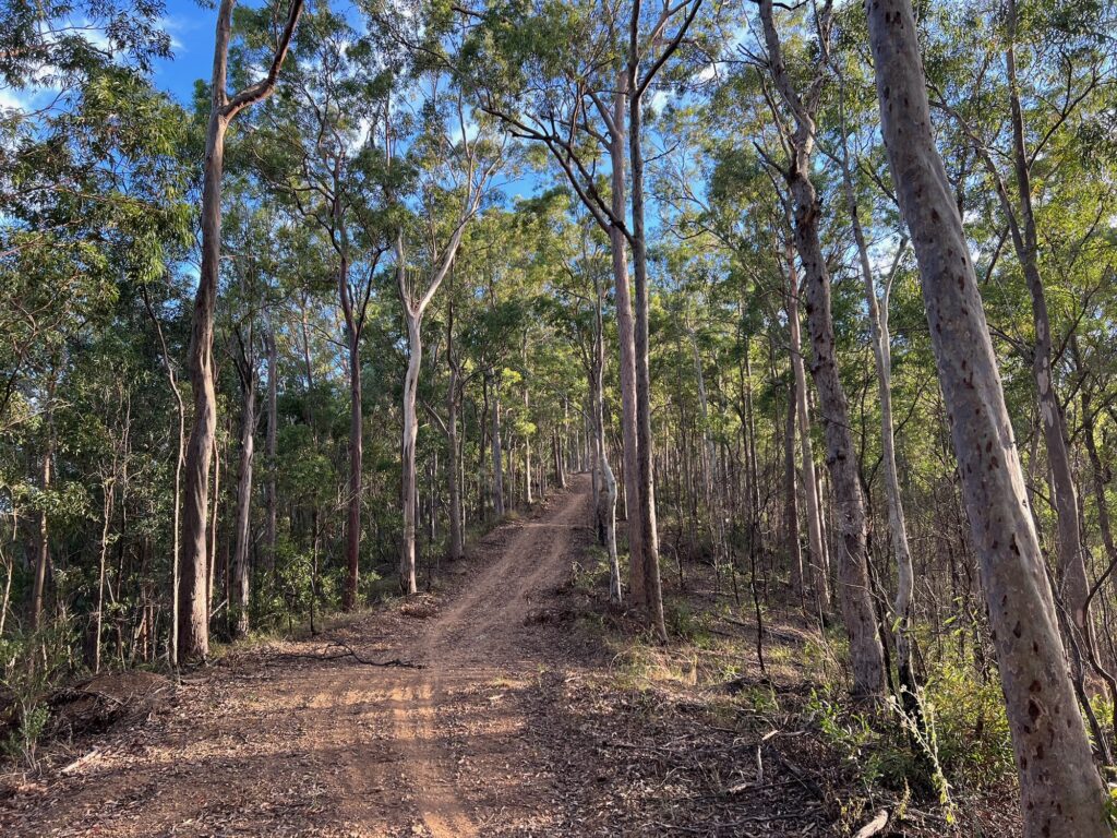
With multiple water bars, you’ll know why it’s called ‘Whoa Boy’! This section can be very loose in the dry, and eroded after storms. Descend within your ability as it is easy to overcook corners or take a tumble on the steep sections. If in doubt – walk! But this is why it’s an advanced gravel ride, and really only suited to experienced bike riders. On a mountain bike it still deserves due respect, mostly around conditions.
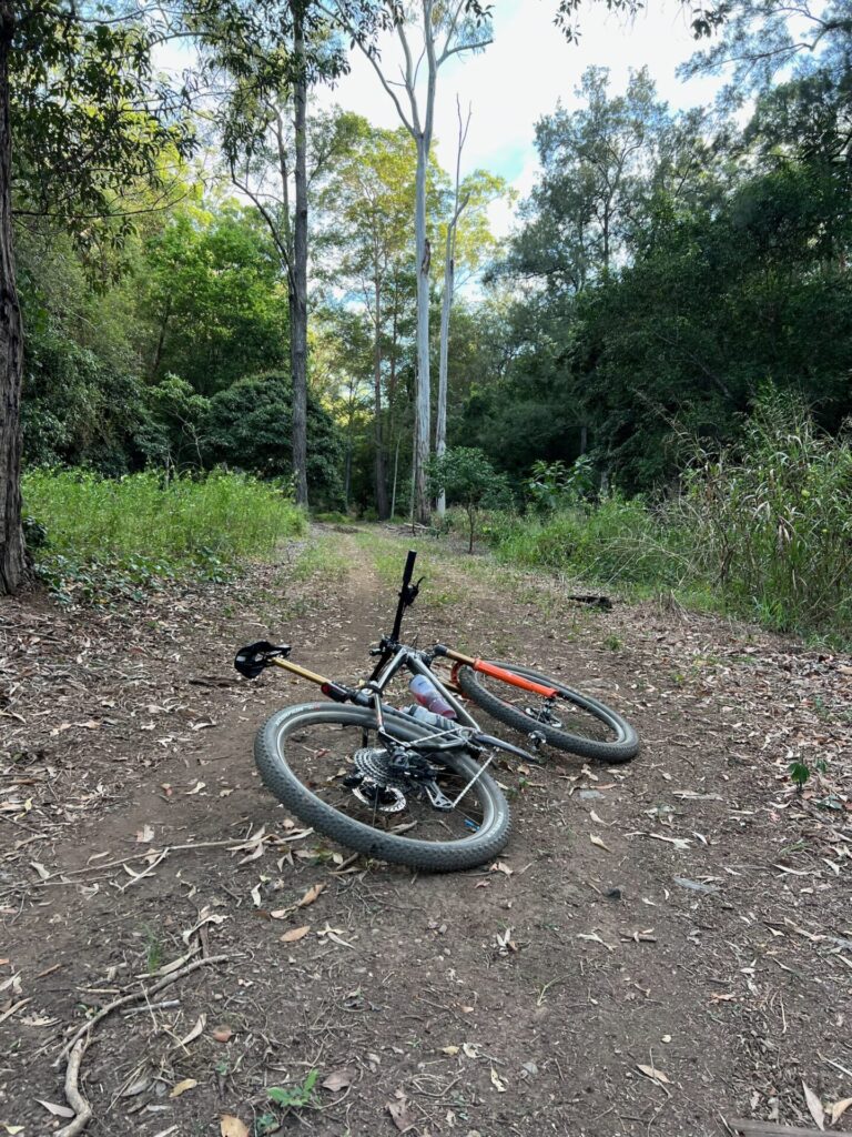
This is an extended descent and finishes in a small clearing. To the right is a path to Banks Creek Road, Fernvale, the BVRT and even Crows Nest if you’re keen. To the left crosses a creek and heads up a steep 4WD climb. There are a couple of steeper pinches! At the top turn left. The right hander ends up on private property. The left follows an old fenceline, up, down, around a sharp right and then a sharp left into a regrowth rainforest gully.
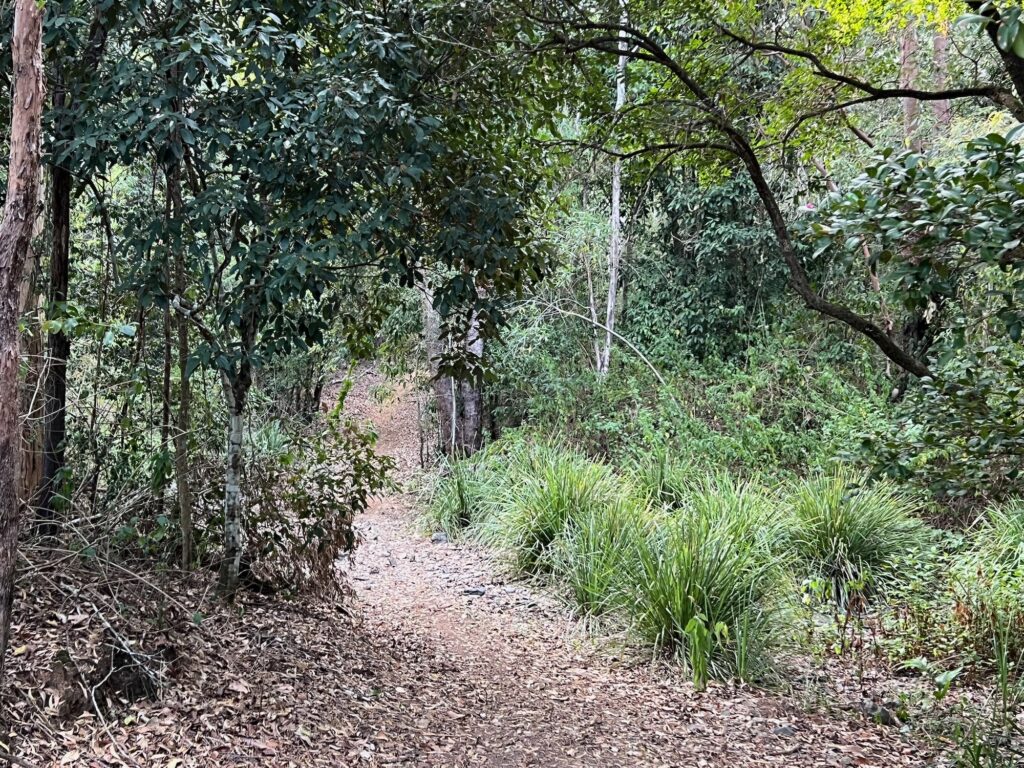
Scythe through here through a tunnel of canopy and ascent the next short but steep climb. Send us a message if you clean it! This is a cross roads but go straight over. Left is a motorbike line to Cabbage Tree Road, right – not sure.
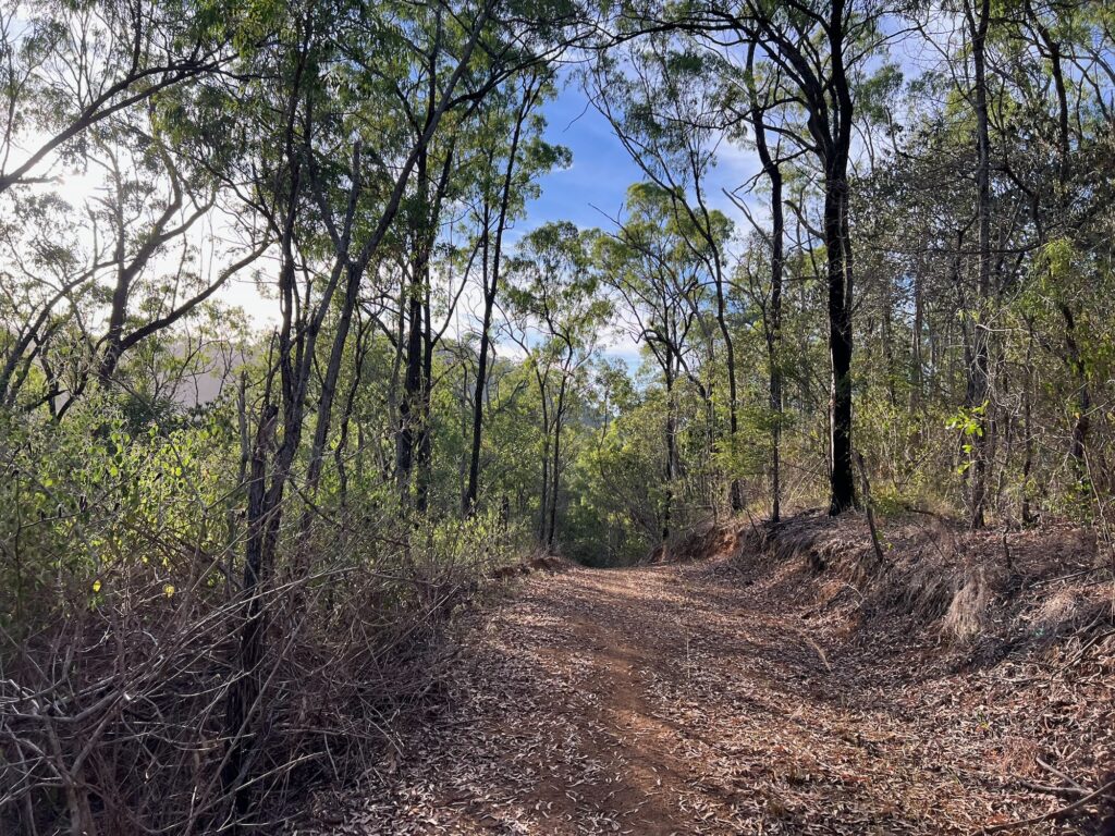
It’s a steep descent with waterbars, and can easily be eroded at the bottom. Proceed with caution – this is Burnt Yard Break. It’s a lot of fun! It does cross the creek and will have wash outs after storms. But, the fairly regular motorbike traffic does provide a very nice informal singletrack line to ride, which takes you to Branch Creek Road. It’s very flat down here – but with just about zero phone reception. Best to ride with a partner and carry some first aid essentials. You can see wild pigs, feral deer, snakes, wallabies – and lots of great native birds.
Turn left onto Branch Creek Road. If you carried downstream you’d head towards Lake Manchester. The route crosses the creek a few times (avoid after rain) and ends up at another junction. Left is Cabbage Tree Road, to return to Dundas Carpark via about 1 hour of climbing. Straight heads up the back of Mt Nebo village, but we’ll turn right to climb Job 6 and the top of Lightline Road.
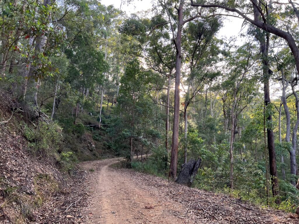
It’s not an easy climb, but makes a nicer loop than doing Cabbage Tree. It is steep and extended, but all rideable by a rider with good condition. Turn left to keep climbing Lightline Road once you join it, and then through the back of Mt Nebo once at the top, and back over Hammermeister again. At this point, follow Mt Nebo Road until the right hand junction to descend down Mt Glorious. This is a very steep road descent – ride with due care and have some lights on for visibility. It has some swimming holes on the left, and will take you right back to Highvale.
An iconic ride for Brisbane bike riders. Do it on your gravel bike or mountain bike for the maximum fun.
User Rating
![]()
![]() (46 reviews)
(46 reviews)
The D\'Aguilar Range west of Brisbane is full of delights for bike riders and outdoors fans. From the rainforest walks near Mt...
User Rating
(3 reviews)
There are nearly endless different rides we can do. Rides that take us to new places, unique vistas and places of interest. T...
User Rating
![]() (17 reviews)
(17 reviews)
In the north-west of Brisbane there are plenty of adventures to be had by bike. This loop suits a gravel bike for those with ...
User Rating
 (6 reviews)